Studio Portfolio Overview
This portfolio showcases a series of research-informed graduate and undergraduate studios I have led across Australia (South Australia, New South Wales, Queensland, and Victoria) and internationally (Canada and Fiji). Each studio reflects a commitment to place-based learning, cultural responsiveness, and community collaboration, often grounded in long-term partnerships with Indigenous communities and knowledge holders.
Through immersive fieldwork, cross-disciplinary inquiry, and creative design processes, students have explored themes such as Indigenous knowledge systems, cultural mapping, counter-mapping, ecological infrastructure, participatory planning, and site engineering. Studios have integrated landscape architecture, geography, anthropology, design theory, environmental studies, and entrepreneurship to generate meaningful and situated design outcomes.
These teaching experiences have not only equipped students with practical and conceptual tools but have also fostered a deeper understanding of Country, relational knowledge, and the social and cultural responsibilities embedded in working with land and communities.
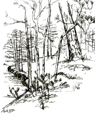
2018 – Exploratory Landscape Architecture Design Studio – Sensing the Landscape
In their first ever design studio, first year landscape architecture students at the University of Canberra developed design responses to a site of their choosing, following deep analysis and investigations of hidden issues pertaining to the site. Students were asked to base their final designs on their understandings of one of three spatial constructs: “Garden, Wilderness, and Landscape.” A selection of design responses features in the clips below:
2017 – Fiji (Viti Levu)

Understanding Indigenous Fijian Knowledge Systems
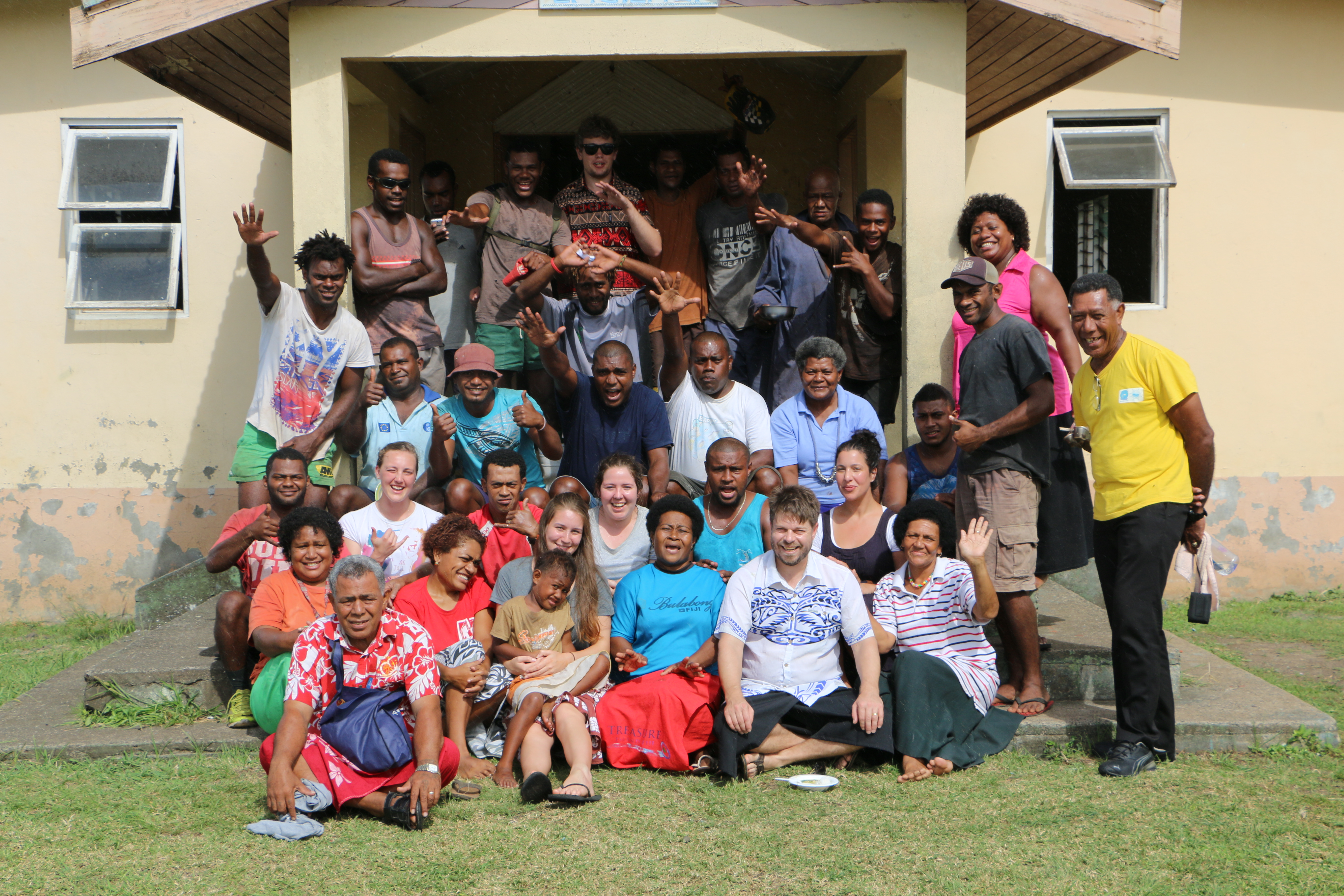
The 2017 Faculty-Led Program (FLP) to Fiji, supported by New Colombo Plan consortium funding, brought together twelve Indigenous Australian students from the University of Canberra and the University of Western Australia to engage with the rich cultural heritage of iTaukei Fijians. The study tour followed a circular route around Viti Levu, beginning and ending in Nadi.
The program was carefully designed to support meaningful, place-based learning and cultural exchange. Students participated in a wide range of activities and site visits that highlighted Fiji’s social, cultural, and environmental landscapes. These included visits to temples, national parks, traditional villages, informal settlements, markets, spice farms, resorts, WWII sites, and institutions such as the Fiji Museum, University of the South Pacific, Fiji National University, the Fiji Arts Council, and the Ministry of iTaukei Affairs. The group also met with dignitaries, including the Fiji High Commissioner to Australia (prior to departure) and the Australian High Commissioner to Fiji.
A highlight of the program was an extended stay in the highland village of Navala, where students deepened their understanding of iTaukei heritage through shared experiences, dialogue, and immersion in daily life. This part of the program was enriched by the participation of six iTaukei students from Fiji National University, whose presence fostered deeper exchange and learning among all involved.
The 2017 program marked the first of three funded study tours to Fiji.
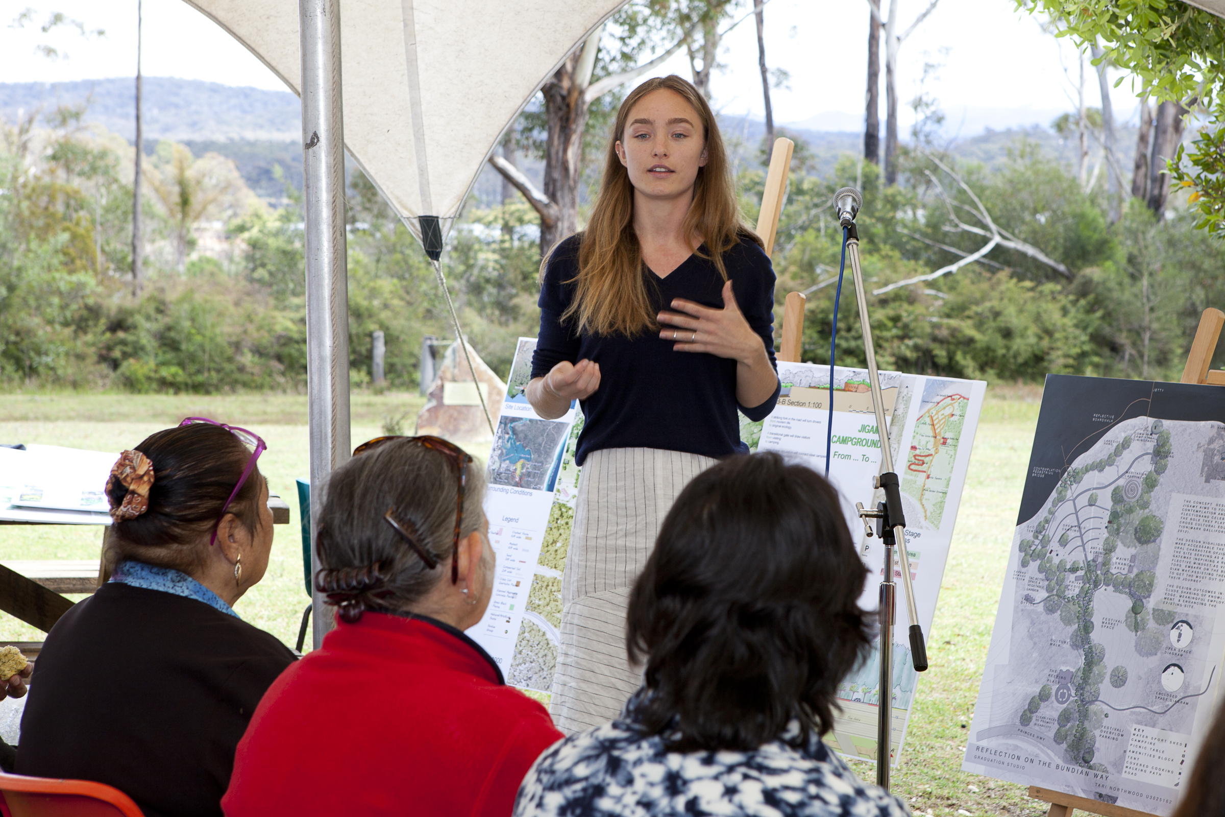
2017 – Jigamy (Pambula), New South Wales
Graduation Landscape Design Studio


This project involved final-year landscape architecture students from the University of Canberra travelling to Jigamy, on Yuin Country, to collaborate with the Twofold Aboriginal Corporation and South East Arts NSW. The students worked closely with community partners to develop design concepts for the 2018 Giiyong Festival—a celebration of Aboriginal culture, art, and storytelling in the region.
At the end of the semester, students presented their concepts to members of the local community, contributing to a shared vision for the festival and gaining valuable insights through dialogue and feedback.
2016 – Fiji (Viti Levu and Ovalau)
Indigenous Conceptions of Landscape, University of Canberra
This field trip to Fiji took place just months after the island nation was struck by a devastating cyclone. It brought together undergraduate and postgraduate students from the University of Canberra studying cultural heritage and occupational therapy. The program offered students the opportunity to engage with Fijian culture, deepen their understanding of heritage in a Pacific context, and reflect on the resilience of communities in the wake of natural disasters.
Students visited a number of culturally significant sites, including areas associated with the early settlement of Fiji by its original inhabitants. They were welcomed into local communities, where they spent time listening to stories, participating in cultural activities, and experiencing aspects of living heritage—such as traditional ceremonies and dances hosted in a village setting. The trip also included a visit to Levuka, the former colonial capital and a UNESCO World Heritage site.
2016 – Jigamy (Pambula), New South Wales
Graduation Landscape Design Studio – Gateway to the Bundian Way
The project (2016–2017) involved final-year University of Canberra landscape architecture students working in collaboration with Indigenous stakeholders at Jigamy, on Yuin Country, to develop interpretive design concepts for the Bundian Way—an ancient Aboriginal trade and cultural route stretching 350 km from the Snowy Mountains to Eden.
The studio focused on designing a campground at Jigamy intended to serve as a welcoming gateway to the Bundian Way. To inform their design investigations, students camped on Country and spent time learning from local knowledge holders about the cultural and historical significance of the region and its trade routes. The project culminated in a community presentation of the students’ design concepts at Jigamy.


2015 – Haycock Point, Ben Boyd National Park, New South Wales
Australia and the Land Studio: Investigating Public Space and Hangout Places

This studio was grounded in a 2015 public space design competition open to landscape architecture students across Australia and Aotearoa/New Zealand. The competition encouraged students to explore the experiences, values, and cultural meanings associated with informal gathering spaces—what might be called “hangout places”—in public landscapes.
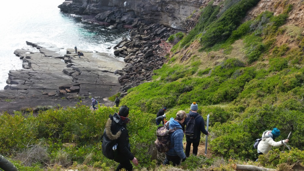
Building on previous teaching and research collaborations with Indigenous communities, a design brief was developed for students from the University of Canberra and the University of Melbourne to investigate the concept of hangouts, inclusive of Indigenous perspectives. With the support of the Local Eden Aboriginal Land Council and the NSW National Parks and Wildlife Service, students undertook a five-day immersive camp at Haycock Point Culture Camp, an Aboriginal site of significance located at the northern end of Ben Boyd National Park on Yuin Country.
The Culture Camp is a contemporary space set aside for the local Aboriginal community to gather, share, and pass on knowledge. The site includes a series of family campgrounds linked to a central meeting place and sits within walking distance of bush food resources, fishing, and diving spots that have been culturally important for generations. While the Culture Camp functions as a modern-day gathering place for Aboriginal families—particularly on weekends and holidays—archaeological and oral histories confirm its use over thousands of years.
By spending time on Country, “hanging out” alongside community members, and listening to the stories and insights of Aboriginal and non-Aboriginal knowledge holders, students gained a deeper understanding of the social, cultural, and historical dimensions of public space. These experiences shaped their design thinking and informed speculative concepts for hangout places in both regional and urban contexts.


2014 – Beachport, South Australia
Australia and the Land Design Studio investigations
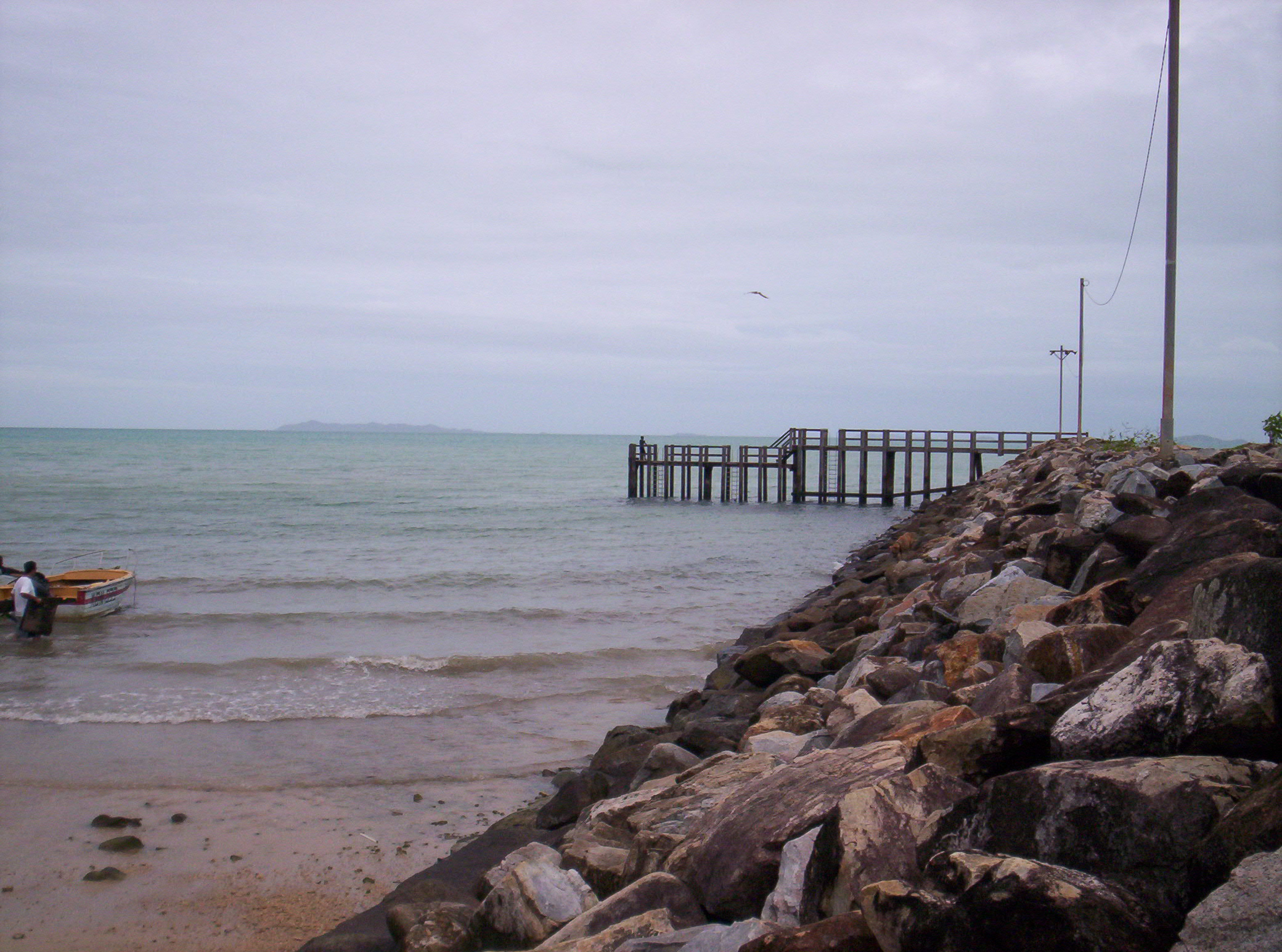
Supported by the federally funded Limestone Coast Coastwatchers program and the Wattle Range Council, this design studio enabled third-year landscape architecture students from the University of Canberra to undertake an access study of the coastal town of Beachport, South Australia.
In September 2014, ten students travelled to Beachport for a week of immersive, place-based research. As part of their coursework for the subject Australia and the Land, students were tasked with documenting the town’s natural and cultural systems to inform the development of an access plan and a series of design concepts. Fieldwork included mapping, observational sketching, film documentation, and note-taking—capturing not only the spatial qualities of Beachport but also insights into local community life.
The experience provided students with valuable skills in site analysis, landscape interpretation, and community engagement, while contributing to a broader regional conversation about accessibility and landscape design in small coastal towns.
2014 – Fiji (Viti Levu and Taveuni)
Indigenous Conceptions of Landscape
Lecturer: Dr Scott Heyes. Assisted by Mr Setoki Tuiteci
University of Canberra 3rd year students
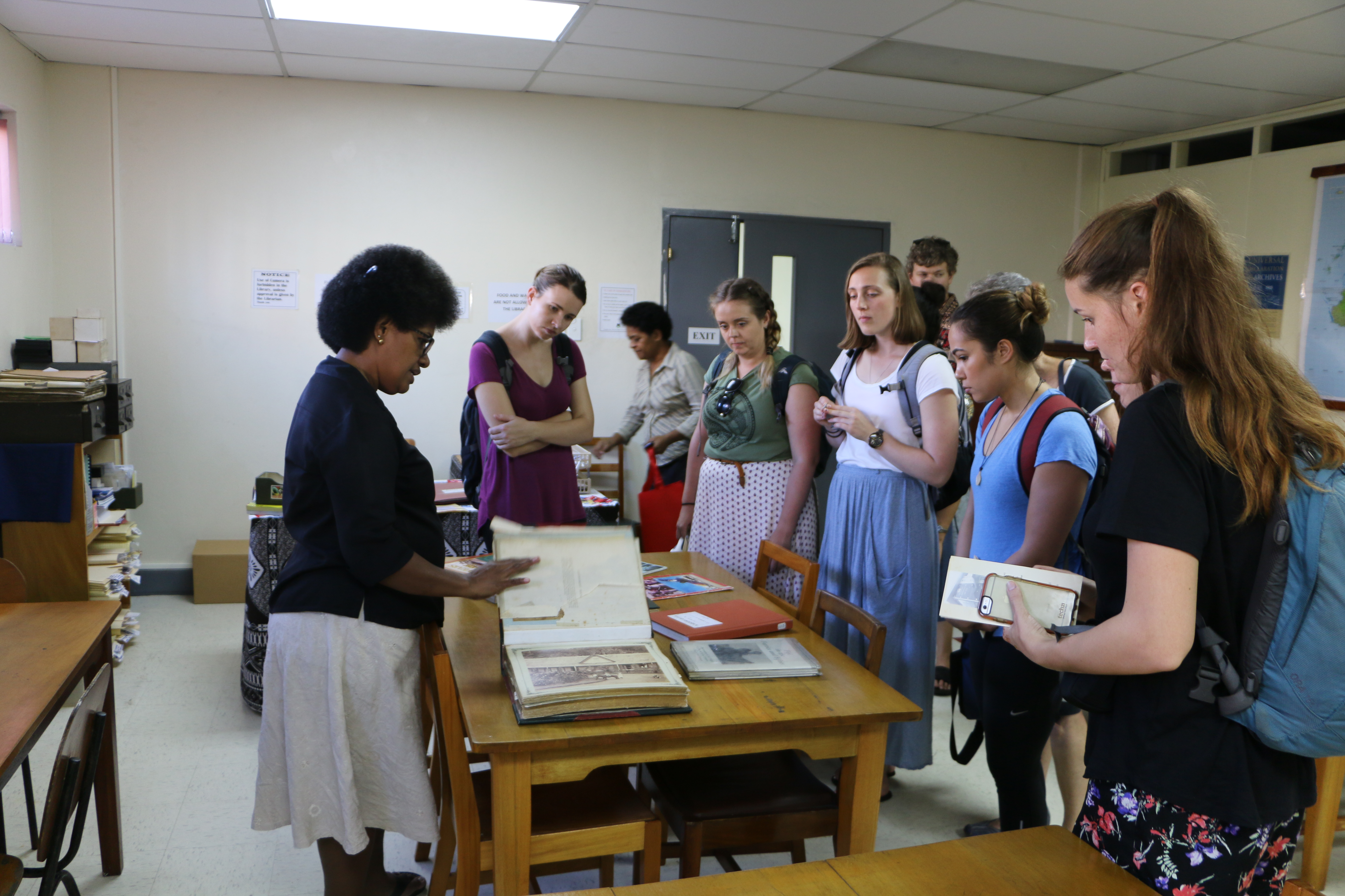
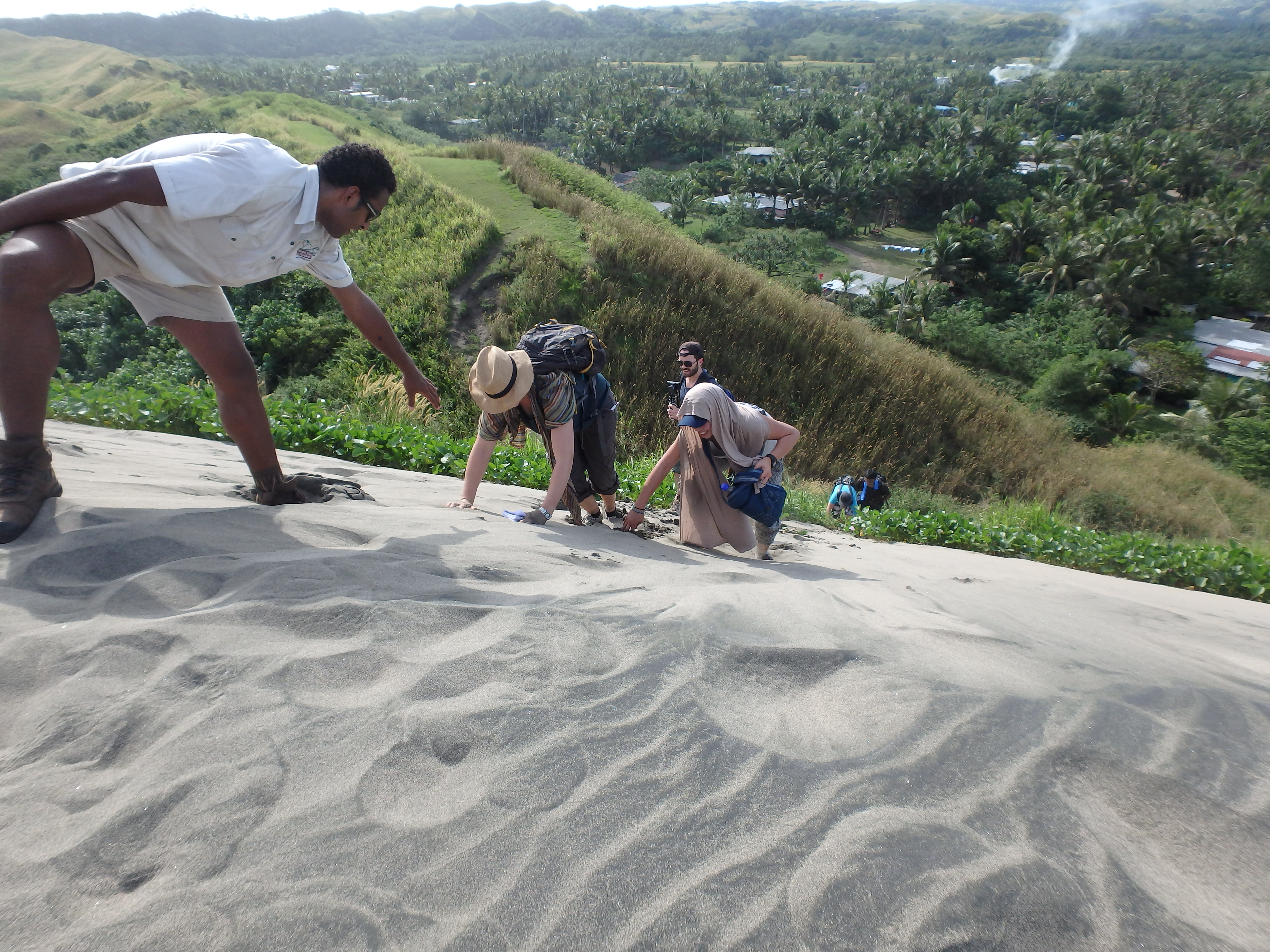
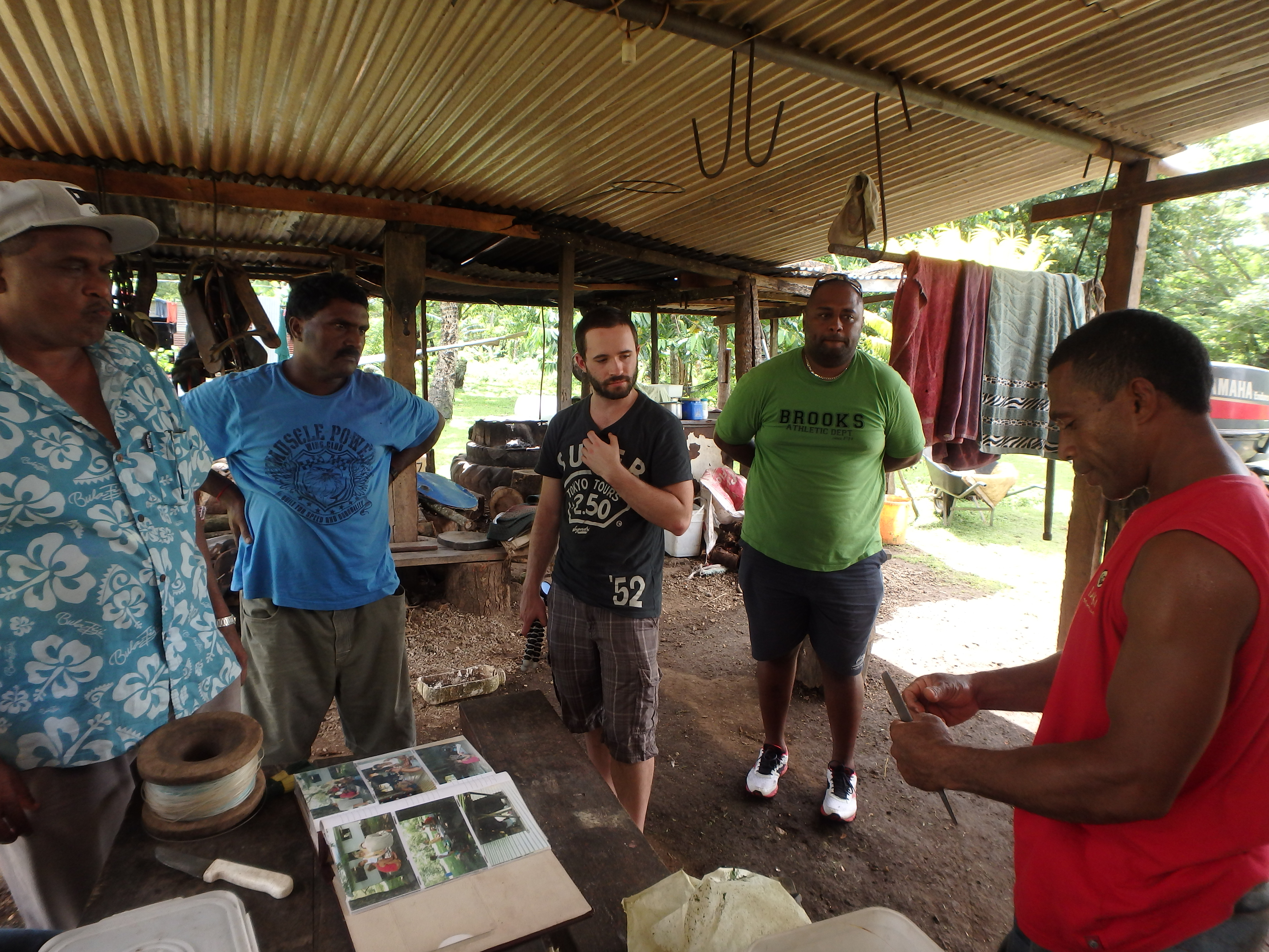
This 10-day Faculty-Led Study Tour to Fiji offered students from the University of Canberra an immersive opportunity to engage with Fijian landscapes, culture, and knowledge systems. Mr Setoki Tuiteci, a Master of Environment (Research) student at UC and an iTaukei Fijian, accompanied the group, offering invaluable insights into Fiji’s geography, language, cultural heritage, and political context.
On Viti Levu, the tour included guided visits to farms, community gardens, villages, and informal settlements in and around Nadi and Suva. A highlight was a guided tour of Lapita archaeological sites at Sigatoka Sand Dunes National Park, where students explored the deep-time history of human settlement in the region. In Suva, students engaged in an enriching dialogue with professors and postgraduate students from the Oceania Centre for Arts, Culture and Pacific Studies at the University of the South Pacific, where they discussed Indigenous knowledge systems and Fijian ways of seeing and understanding the land.
The final leg of the tour took place on the island of Taveuni, where students met with teachers and pupils at South Taveuni Primary School to support the development of an eco-library—envisioned as a cultural and environmental learning hub for the school and the surrounding village of Vuna. The project centres on celebrating the deep relationships between the people of Taveuni and their local environments, including native flora and fauna.
The group was welcomed with generous hospitality, including traditional Fijian and Hindu performances by students, shared meals, and cultural exchanges. We were warmly hosted by several schoolteachers and Village Elders, who generously guided students through the broader cultural and ecological context of the area. These experiences included visits to temples, farms, and places of cultural significance—offering deeper insight into local lifeways and relationships to land.

2013 – Mount Gambier, South Australia
Lecturer: Dr Scott Heyes | Tutor: Mr Setoki Tuiteci
3rd Year Landscape Architecture Students
Theme: Cultural Mapping / Counter-Mapping
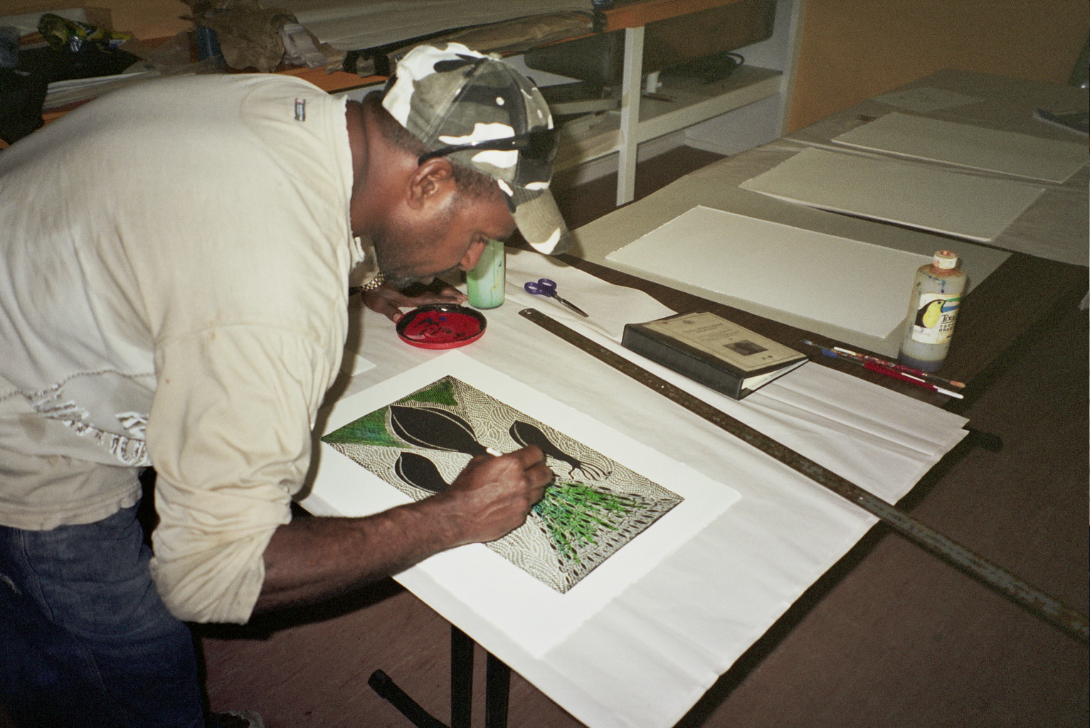
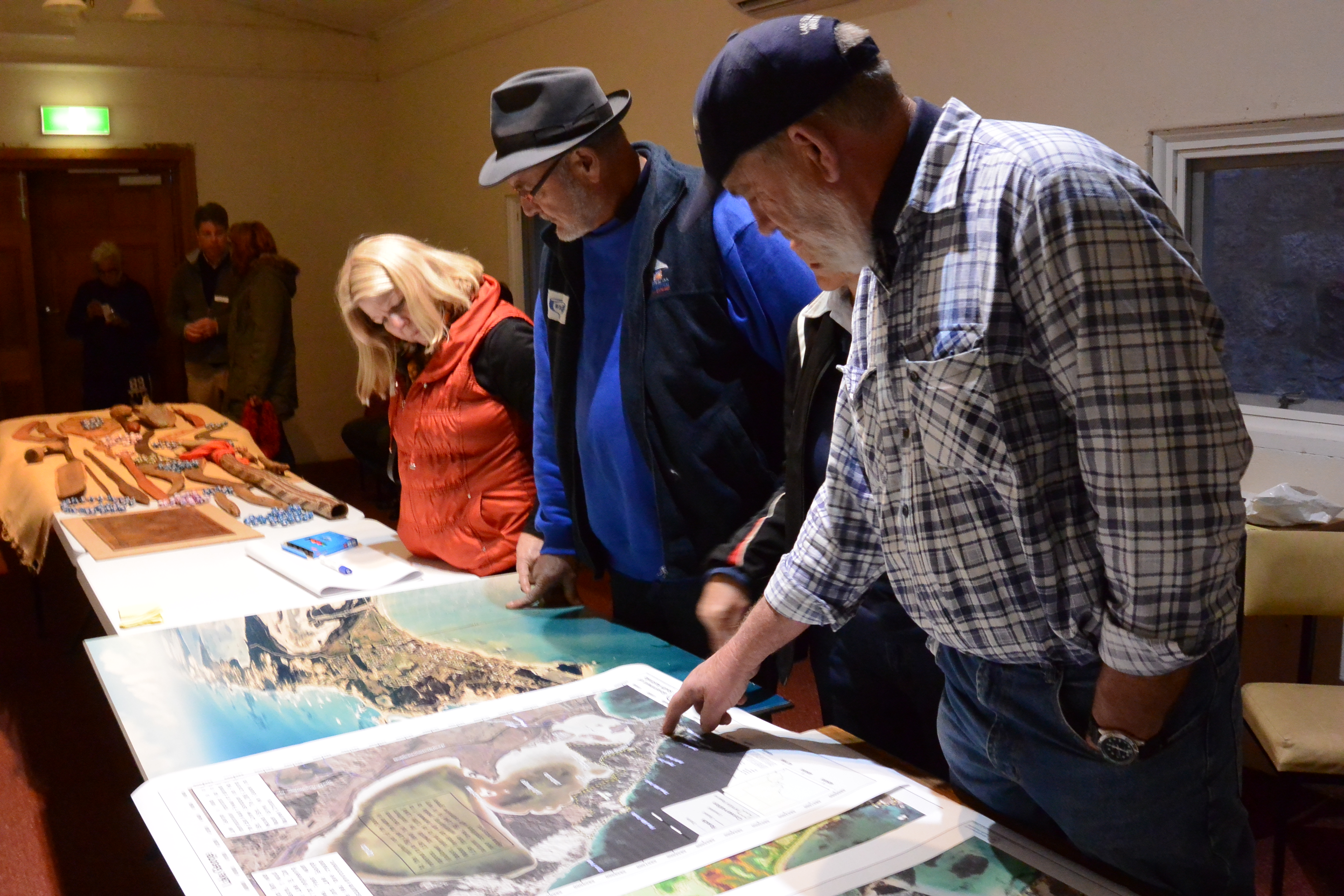
This studio was based in Mt Gambier, South Australia, and involved a collaboration between the University of Canberra, the City of Mt Gambier, and the South East Aboriginal Focus Group. The aim was to explore the cultural landscape of the region through the creation of conceptual and counter maps that centred Aboriginal perspectives and knowledge systems.
In September, students travelled to Mt Gambier for a week of immersive fieldwork. Working in small groups, they were hosted by local farmers, botanists, archaeologists, and foresters, who generously shared their knowledge of the region’s ecological and cultural heritage. Students were tasked with developing “counter maps” of the countryside—maps that challenge dominant narratives—drawing on these local interactions, archival research, and literature studied during the semester.
Each group was allocated a section of Country to explore—spanning areas of 60 to 100 kilometres. Over nine weeks, they developed layered visualisations of their transects, which were expressed as large-format models mounted on 1.2 x 2.4 metre panels. Crafted by hand and using tools from the university workshop, many of the panels featured moving parts and embodied a high level of creative engagement.
The studio culminated in a presentation to an expert jury, alongside the submission of individual visual journals. Following this, the panels were transported to Mt Gambier for a public exhibition titled Transects – Windows into Boandik Country, held at the Main Corner Art Gallery. The exhibition was launched on 6 December 2013 by Boandik Elders and accompanied by a printed booklet that introduced the project and its themes.
This studio marked the beginning of a longer-term engagement with the Boandik community and their aspirations to establish a living cultural centre in the region.
2013 – Cherbourg, Queensland
Landscape Research Studio 1 (8961) & Landscape Architecture Design Studio 3 PG (8270)
Lecturer: Dr Scott Heyes | Tutor: Dr Steve Burroughs
Theme: Designing Infrastructure for Community Benefit
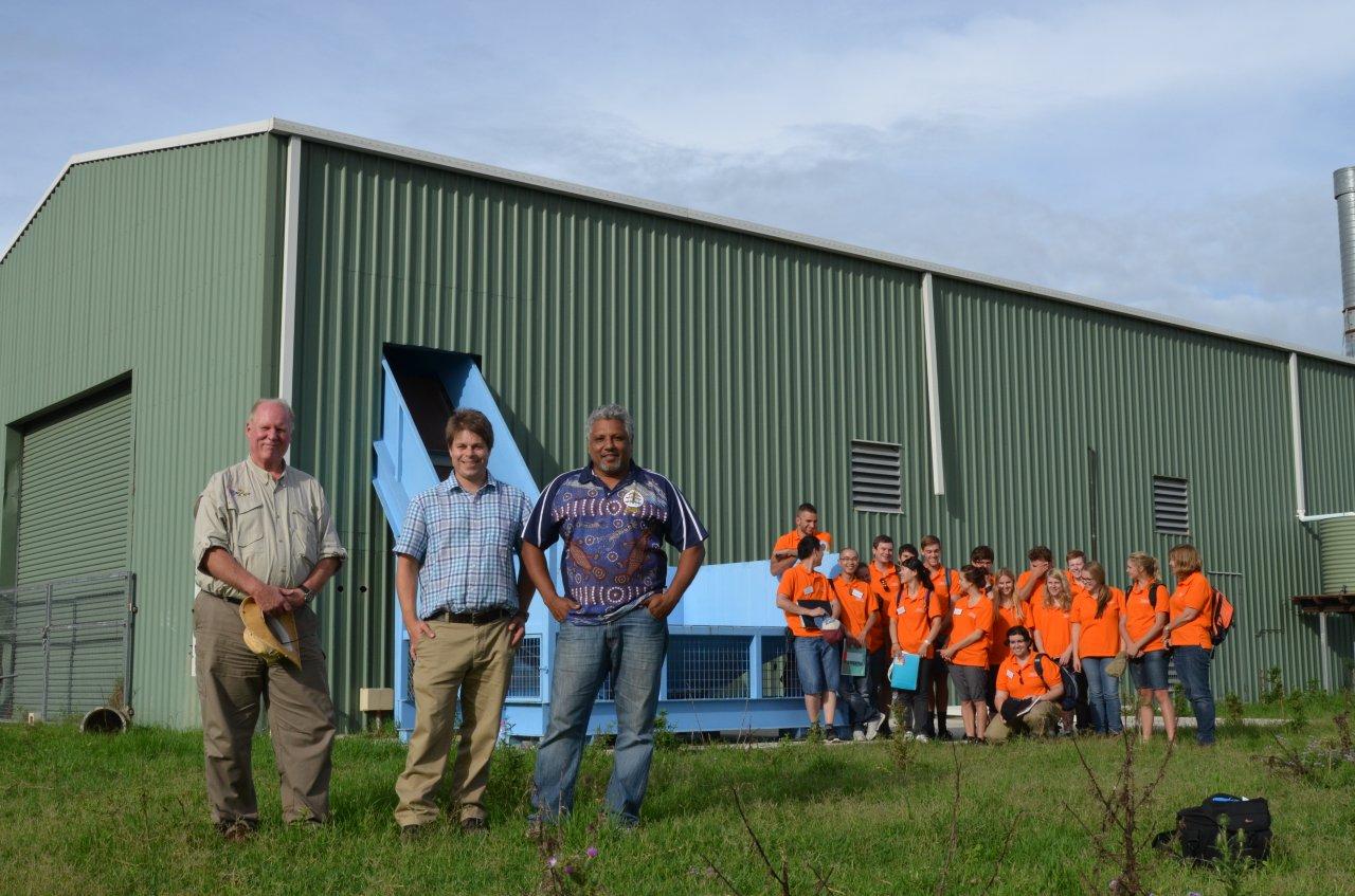
This studio focused on the research and design of a proposed Materials Recycling Facility (MRF) to serve the Aboriginal community of Cherbourg in rural Queensland, along with nearby townships. The project was supported by the Cherbourg Aboriginal Shire Council, who acted as the client, and aimed to explore how design can support sustainable infrastructure in a culturally appropriate and community-responsive way.
Students undertook a five-day field trip to Cherbourg, where they visited the proposed site, engaged with the local context, and began formulating design ideas. The fieldwork was guided by Dr Steve Burroughs, the project’s lead architect, who was commissioned to bring the MRF to realisation.
Following the field trip, students spent nine weeks in studio refining their design proposals. Drawing on field data, local insights, and research on best practices in recycling infrastructure, they developed site-specific concepts that considered environmental performance, community needs, and cultural context.
The studio concluded with a formal presentation to a design jury, which included professional landscape architects, a representative from Indigenous Business Australia, and recycling industry proponents.
2011 – Pick Swamp, South Australia

Landscape Architecture Studio 1
Collaborative Design with Country
This studio invited students to develop a masterplan and detailed design proposals for a proposed park at Pick Swamp, near Mount Gambier, South Australia. The design brief encouraged students to consider how Indigenous knowledge, history, and ongoing connection to place could inform and shape the design response.
To support this, students travelled from Canberra to Mt Gambier for a five-day field visit to explore the Pick Swamp site and engage with members of the Boandik community, the Traditional Custodians of the region. As part of the research process, students facilitated workshops with a range of stakeholders, including Boandik Elders and knowledge holders, representatives from the South Australian Department for Environment and Water (National Parks and Wildlife), the South East Natural Resources Management Board, local residents and landholders, and birdwatching groups.
The studio emphasised culturally responsive design practice, ecological awareness, and collaborative approaches to landscape planning. The report generated by the students is available for download Pick Swamp and Picannie Ponds Site Analysis and Concept Designs

2010 Temagami (Camp Wanapitei), Northern Ontario, Canada
Indigenous Conceptions of Landscape
4th Year Undergraduate Course – Fall 2010
Trent University, Peterborough, Ontario
As part of a fourth-year course on Indigenous conceptions of landscape, students participated in a four-day field trip to Temagami, Northern Ontario, from 23–26 September 2010. The field component was hosted at Camp Wanapitei and grounded in experiential learning, with a focus on Indigenous ways of knowing, relating to, and navigating landscapes.
Drawing on field activities and seminar discussions, students explored a range of themes in their final papers, including Indigenous access to land and resources, traditional knowledge systems, therapeutic landscapes, environmental navigation, and cultural understandings of inland waterways and seascapes.
2009 – Budj Bim National Heritage Landscape (Gunditjmara Country, Victoria) & Teeluk (Ngarrindjeri Country, South Australia)
Indigenous Conceptions of Landscape
Melbourne School of Design
Coordinator & Lecturer: Dr Scott Heyes | Guest Lecturer: Dr Garrick Hitchcock (Arafura Consulting)
This multidisciplinary subject introduced students to diverse ways of knowing and seeing landscapes, with a focus on Indigenous perspectives from Australia, the Pacific, and Canada. Students from backgrounds in design, geography, anthropology, and environmental studies participated in a series of seminars and a field-based learning experience that explored Indigenous conceptions of place, time, environment, and belonging.
Seminar themes were grounded in readings and discussions on topics such as Indigenous understandings of time and seasonality, toponymy, land units, and relational connections to “nature.” Broader conversations included epistemology, ethics, and approaches to fieldwork in cross-cultural contexts.
The five-day field trip, held at the start of the semester, involved camping and on-Country learning within the homelands of two Indigenous communities: the Budj Bim National Heritage Landscape near Heywood, Victoria (Gunditjmara Country), and Teeluk, at the southern end of the Coorong near Kingston, South Australia (Ngarrindjeri Country). Students were guided by community representatives to sites of cultural and historical significance, where they listened to stories, learned from lived experience, and engaged in respectful dialogue around land and knowledge.
Each community invited students to consider ways educational resources might be developed to communicate the cultural significance of key sites to visitors. During the trip, students kept journals and produced field sketches, and participated in storytelling and reflection around the campfire—deepening their understanding of Indigenous relationships to Country through embodied and collaborative learning.
2009 Dight’s Falls, Melbourne, Victoria
Site Tectonics – Melbourne School of Design
Master of Landscape Architecture
Coordinator & Lecturer: Dr Scott Heyes
Tutors: Dan Borg, Simon Fuller, Gabriel Fuenzalida
Guest Lecturers: Mark Donnellan (City of Yarra), Roger Hughes (Dept. of Engineering, University of Melbourne), Stephen Saddlier (Arthur Rylah Institute), Prof. Bob Keller (Monash University)
This subject introduced Master of Landscape Architecture students to the core principles of site engineering through two integrated modules focused on hydraulics, drainage, earthworks, surveying, and technical design.
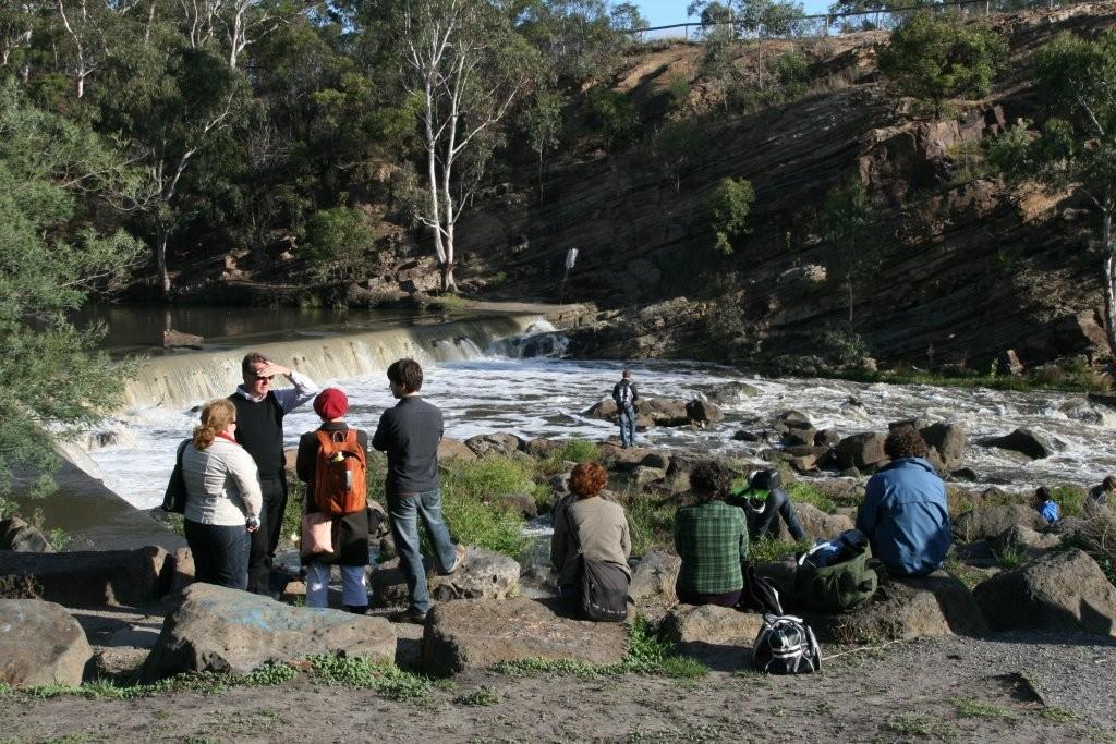
Module 1 – Rock-Ramp Fishway Design, Dights Falls (Yarra River)
Students explored the fundamentals of hydraulics and drainage through a real-world design brief: the redesign of a rock-ramp fishway at Dights Falls on the Yarra River. Using field, laboratory, online, and classroom exercises, students applied hydraulic calculations to support ecologically informed and structurally sound design solutions.
The brief required consideration of river flows, level changes, fish ecology and behaviour, the riparian environment, and the visual character of the river corridor. Students were also tasked with integrating a viewing platform or landing into their designs. Final concepts included grading and planting plans, hydraulic calculations, construction details, and physical and digital models of their proposed fishways.
Module 2 – Surveying and Site Mapping, Lincoln Square
In this module, students conducted field-based surveying and levelling exercises at Lincoln Square near the University of Melbourne. Using standard surveying equipment, they generated accurate site plans, mapping topographic contours and key site features through fieldwork and data calculations.
Throughout the semester, students were supported by guest lecturers with expertise in engineering, ecology, and urban design. A series of self-paced online learning modules also complemented the course, allowing students to engage with core material in their own time and reinforce key technical skills.

2009 – Doncaster Hill, Melbourne, Victoria
Site Planning and Design – “Lines: Traces, Threads and Surfaces”
Master of Landscape Architecture (300 pt)
Coordinator & Lecturer: Dr Scott Heyes | Tutor: Gary Lantzsch
This studio explored planning and design options for a linear site of approximately three kilometres at Doncaster Hill in Melbourne’s northeast. With support from the City of Manningham and guided by strategic planning frameworks for the region, students developed a suite of sustainable and imaginative concept designs for public space, ecological infrastructure, and pedestrian connectivity.
To ground their proposals, students undertook multiple site visits and collaborated on a class-wide site inventory and analysis report. The studio’s conceptual foundation was framed by two key texts—Tim Ingold’s Lines (2005) and Brian Greene’s The Elegant Universe (2003). These readings inspired students to critically examine how landscape can be understood and represented through the metaphors of traces, threads, and surfaces, challenging conventional modes of perception and mapping.
Design outcomes reflected both analytical insight and poetic interpretation of place. Students proposed rain gardens, wetlands, water features, plazas, gathering spaces, underpasses, land art installations, traffic calming measures, street realignments, and integrated lighting strategies—each contributing to a layered and responsive vision for the Doncaster Hill corridor.
2008 – Coorong National Park, Younghusband Peninsula, Lake Albert & Lake Alexandrina, South Australia
Indigenous Conceptions of Landscape
Melbourne School of Design
Coordinator & Lecturer: Dr Scott Heyes
This subject introduced students to diverse Indigenous relationships with place, homelands, water, and the spiritual and material worlds. Drawing on examples from Australia, Canada, and the Pacific, students explored Indigenous ways of perceiving, knowing, and living with landscapes and aquatic environments.
A key focus of the subject was the categorisation and classification of land and water units by Indigenous peoples, highlighting how these systems differ from Western land management and place-making frameworks. Through seminar discussions and readings, students gained an understanding of the cultural values, responsibilities, and knowledge systems that bind Indigenous peoples to Country.
A multi-day field trip to Coorong National Park—including visits to Noonamena, the Younghusband Peninsula, Lake Albert, and Lake Alexandrina—formed an integral part of the subject. Students engaged in on-Country learning, guided by Ngarrindjeri community members and Traditional Custodians of the region, deepening their understanding of the cultural and ecological significance of these interconnected landscapes.
The subject culminated in a student-led exhibition titled Cultural Waters: Reflections on Ngarrindjeri Connections to the Coorong and Lower Lakes, South Australia, held from 17–24 October 2008 in the Atrium of the Architecture Building at the University of Melbourne.
2008 – Inverloch, Victoria

Inverloch, Victoria – Site Planning and Design Studio
Melbourne School of Design
Master of Landscape Architecture (300 pt), Semester II
Coordinator & Lecturer: Dr Scott Heyes | Tutor: Tom Richards (Landscape Architect)
This newly developed studio focused on small-scale planning and design opportunities for the coastal township of Inverloch, located in the Gippsland region of Victoria. The project was supported by the Bass Coast Shire Council, with the Council’s Strategic Environmental Planning Officer playing a key role in facilitating community engagement.
Over a three-day site visit, students conducted landscape surveys and met with a range of community members to better understand local perspectives, aspirations, and challenges. Based on this fieldwork, students prepared a comprehensive landscape analysis and inventory report, which was submitted to the Council during a public presentation held in the final week of the semester.
The presentation was well attended by Inverloch residents and key representatives from the Shire Council. A summary of student design concepts developed during the studio was included in the report to support further planning and community dialogue around the future of public space and environmental management in the township.

2008 Dight’s Falls, Melbourne, Victoria
Graduate and Undergraduate Subject
Lecturer: Scott Heyes | Tutors: Kevin Ayrey, Gary Lantzsch, Tom Richards, Dan Borg
This subject introduced students to the principles of site engineering through a design-focused investigation of Dights Falls on the Yarra River, Melbourne. The project centred on developing design options for a fishway, spillway, and associated infrastructure, with an emphasis on understanding hydraulic behaviour and river system dynamics.
Students engaged in both theoretical and applied learning, including instructional sessions in the Hydraulics Laboratory within the University of Melbourne’s Engineering Department. The studio encouraged experimentation and innovation, with students producing both digital and physical models of a proposed weir system for the Yarra River as part of their final project.
The hands-on approach proved to be an effective and engaging way for students to develop foundational knowledge in site engineering while also exploring real-world environmental design challenges.

2007 – Moa and Badu Islands, Torres Strait, Queensland
Investigation Program (project co-leader)
University of Melbourne
This project involved travelling to Moa Island, where design students from the University of Melbourne undertook investigations of cultural aspects of design with community leaders.